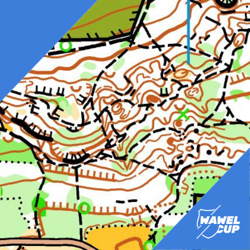
In beginning of the last week of preparations for the competition, we present the description of the area of stage number five. The race, which will be held almost in the center of Krakow, will take place mostly in the forest surrounding the Kościuszko Mound. There is a large number of roads and paths and all kinds of contour details – depressions, troughs, mounds, rock walls. The runnability varies from good to, in some places, difficult. Lot of climbing – the relative height from the lowest to the highest point – 75 meters.
The end of the course will be held around the Cracovia hall. For this reason, we arranged a change of map scale for some categories. The last point on the forest map will be the start on the sprint map. Finish at Krakow’s Błonia, in the heart of the Polish kings’ capital!